GovDocs/Maps
You cant read this, or can you?
About askcarlos.com
Contact AskCarlos.com
Handouts/Course-related assignments
Staff
Federal Government
Alphabetical Listing
Branches of the Federal Government
The President & Cabinet
The Congress
The Courts
Boards & Commissions
Independent Establishments
Quasi-Official Agencies
Quick Reference: Government Information by Subject
Government Reference
Forms of Address and Salutations of Federal and State Officials
Historical Documents
FDLP Electronic Collection
GovSpeak: A Guide to Government Acronyms & Abbreviations
GPO Access Databases
GPO Tools: Indexes to Federal Government (1909 Checklist)
1909 Checklist
Census Publishing Information, 1790 - 2010
Catalog of US Govt. Publications (CGP)
Catalog of US Govt. Publications (CGP)
GPO Tools: Indexes to Federal Government (1909 Checklist)
1909 Checklist
Census Publishing Information, 1790 - 2010
Citing Government Information in MLA of APA Style (DocsCite)
Quick Reference: Government Information by Subject
Symbols of the United States
US Federal and State Tax Forms Online
GovJOBS
State Government
US Federal and State Tax Forms Online
Voter Registration Information
Washington State
Washington State Government Information
Thurston County
Quick Reference: Government Information by Subject
U.S. Federal and State Tax Forms Online
GovJOBS
Pacific NW States
Pacific NW Information
Northwest Government Information Network (NGIN)
US Federal and State Tax Forms Online
The 50 States
Legal Information
Official State Websites
State Jobs
State Maps
State Tax Forms
Tribal Government
Alphabetical Listing
State Listing
Tribal Listing
Native Photo Gallery
Photo Gallery
International Information
Canadian Government
Country Information
International Organizations
Environment and Sustainable Developmen
Global Trade and Finance
Humanitarian
Intergovernmental Associations
Justice and Law
Labor
Scientific and Technical
United Nations
Women
Image Resources
Maps Resources
Digital Maps Archives
Maps & GIS Links
State Maps
Legal Resources
QuickRef: Government Information by Subject
Countries of the World
Economic Indicators
Education
Environment
Grants
Health
Mapping & GIS
Salmon
Native Americans
Statistics
Ask a Reference Question
Hot Topics
Asian / Pacific American Heritage Month
Coloring Books
Dams!
GovJOBS
National Bike Month
National Hispanic Heritage Month
National Men's Health Month
No Child Left Behind
USA PATRIOT Act
Washington State Women's History: Suffrage Centennial, 1910 - 2010
We The People, The Story of the U.S. Constitution
Women's History Month
Home
Digital Maps Archives: The Evergreen State College (TESC) Maps
Last updated: July 29, 2010
Organic Farm Layout
from October 9, 2008
36" x 24"
TESC Site Plan
Aerial
: from March 2, 2005
36" x 24"
Site Plan
: from April 9, 2009
36" x 24"
Topographic 5' Contours
: from April 9, 2009
36" x 24"
TESC Topographic Map
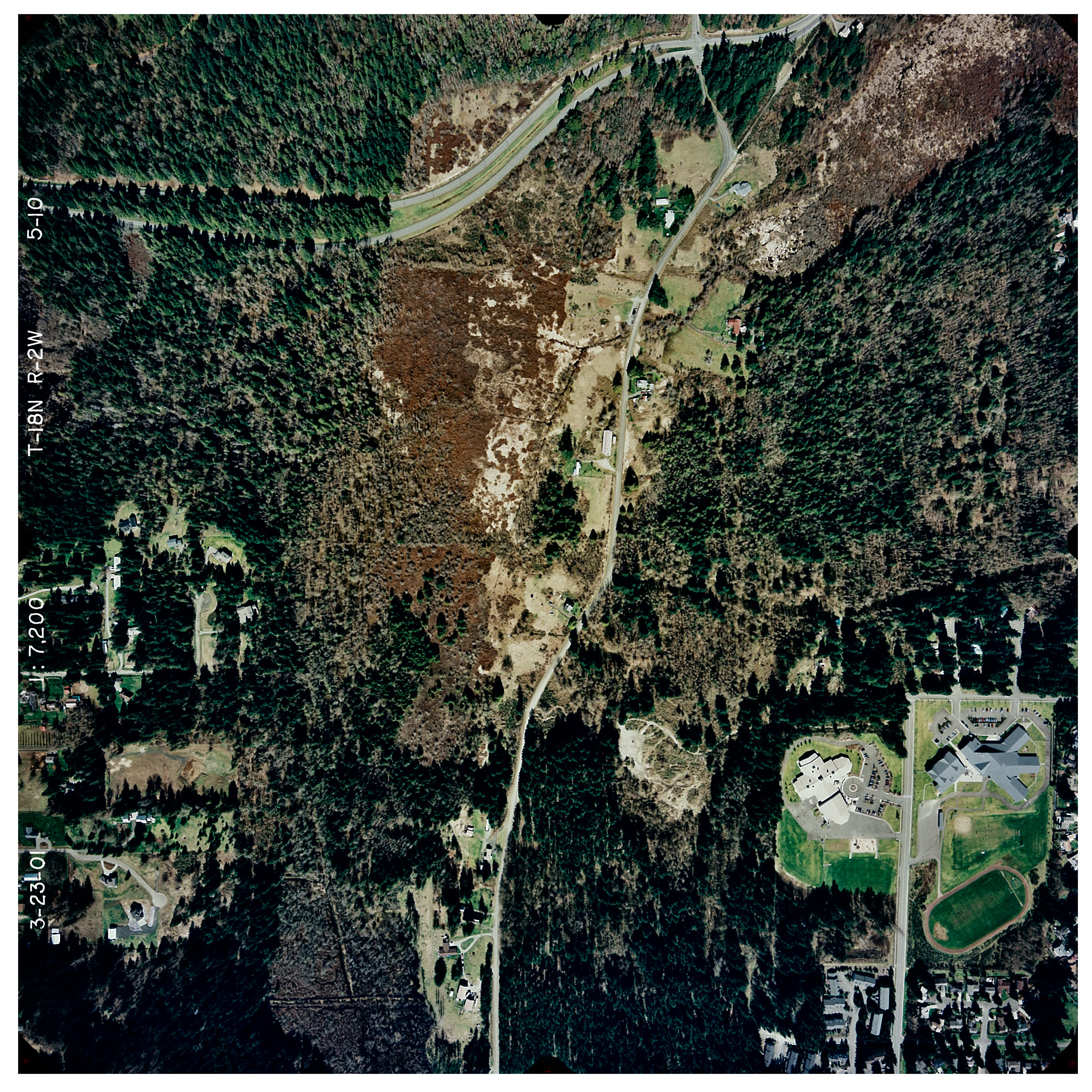
TESC Aerial Photos
March 23, 2001
5-10
5-11
5-12
5-13
5-14
Trails
Aerial Physical
by Sean Patrick
Aerial Black & White
by Paul Potasnik
Aerial Color
by William Ritchie
Aerial Photographic
by Nathan Schurr
Aerial with Insets
by Andrea Siatkowski
Campus Maps
Campus Map, 2009
Campus Map with Trails, 2009
Most Current Campus Map
TESC Campus shapefiles
(.shp)
TESC Forest Canopy Maps
TESC Forest Canopy
TESC Forest Canopy with Trails
TESC Forest Canopy shapefiles
(.shp)
Search Library Catalog for
Government Documents
