Pre-19th Century Maps
Mudflows:
Areas Inundated by Mudflows
at Mount Rainier in the last
5,600 Years
Holocene Mudflows
|
19th Century Maps
Area and Vicinity Maps:
View of New Tacoma and Mount Rainier (1878)
Forest:
Mount Rainier Forest Reserve, Washington,
showing classification of lands (1899)
Glacier System:
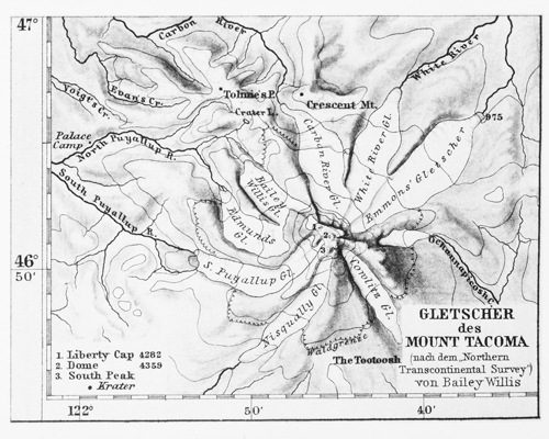
Glacier of Mount Tacoma (1886)
(Gletscher des Mount Tacoma)
Glacier System of Mount Rainier (1896)
.jpg format
Highway/Transportation:
Map of Pierce County (1897)
The mountain is labeled as Mount Tacoma,
includes glaciers and the Summit Mining District
|
20th Century Maps
Area and Vicinity Maps:
Mount Rainier Vicinity Map (1997)
Boundaries:
Plat of the Survey of the Boundaries of
Mt. Rainier National Park, Washington (1908)
Metsker's Map, Pierce County (1950)
Forest:
Rainier Forest Reserve (1906)
Rainier National Forest (1918)
Rainier National Forest (1923)
Rainier National Forest (1930)
Rainier National Forest (1931)
Snoqualmie National Forest (1911)
National forest boundary, divide
forming national forest boundary,
transferred from Rainier National Forest.
Glacier System:
Major Glaciers of Mount Rainier (1997)
Hazard Maps:
Hazards Zones for Lahars, Lava Flows, and
Pyroclastic Flows from Mount Rainier (1998)
Mount Rainier Hazards Map, Plate 1 (1998)
Mount Rainier Hazards Map, Plate 2 (1998)
Highway/Transportation:
Map of Pierce County (1936)
Pierce County (1940)
Sheet 2 of 5 (Nisqually area)
Topographic Maps:
Mount Rainier National Park (1907)
Mount Rainier National Park
First Topographic Map
7.5 minute series (1915)
.jpg format
Mount Rainier (1924)
7.5 minute series, 1:125,000 scale
Topographic map 1:50,000 scale (1971)
33" x 33"
Water:
Major Stream Drainages (1997)
|
21st Century Maps
Area and Vicinity Maps:
Mount Rainier Area Map (May 2007)
Mount Rainier Vicinity Map (May 2007)
Wilderness Trip Map Planner (2006)
Boundaries:
Land Records
via WA State Digital Archives
Plats and Survey Records
via WA State Digital Archives
Campgrounds:
Backcountry Camps and
Wilderness Zones (2004)
Cougar Rock Campground
Ipsut Creek Campground
Ohanapecosh Campground
White River Campground
Climbing Routes:
Paradise Climbing Routes
Trails:
Bench Snow Lakes Trails (2009)
Burroughs Mountain Trail (2009)
Carbon Glacier Trail (2009)
Carbon Glacier and Mystic Lake Trail (2009)
Comet Falls Trail (2009)
Crystal Lakes Trail (2005)
Eagle Peak Trail (2009)
Emerald Ridge Trail (2009)
Glacier Basin Trail (2009)
Gobblers Knob Trail (2009)
Green Lake Trail (2009)
Indian Bar (2009)
Indian Henry's Hunting Ground
via Kautz Creek Trail (2009)
Klapatche Park Trail (2009)
Lake George Trail (2009)
Lake James Trail (2009)
Longmire Area Trails (July 2007)
Morain Park Trails (2009)
Mount Freemont Lookout (2009)
Muir Snowfield Bearings (Get Your Bearings)
Mystic Lake Camp Trail - Sunrise (2009)
Mystic Lake Trail, Carbon Lake and (2009)
Naches Peak Trail (2009)
Narada Falls (2009)
Northern Loop Trail (2009)
Ohanapecosh Area Trails (July 2007)
Owyhigh Lakes Trail (2009)
Pacific Crest Trail (2009)
Palisades Lakes (2009)
Paradise Area Trails (July 2007)
Sunrise Area Trails (July 2007)
Shriner Peak Trail (2009)
Silver Falls Trail (2009)
Spray Park Trail (2009)
Summerland Trail (2009)
Three Lakes Trail (2009)
Tolmie Peak Trail (2009)
Van Trump Trail (2009)
Windy Gap Trail (2009)
Watersheds:
Watershed Maps
via Shared Strategy for Puget Sound
|
